Building date: 1849
Original use: Barn
Corner structures: The quoins are gray limestone and are variable in size.
Mortar application and content: Stones are set in a matrix of mortar which is almost flush with the stones.
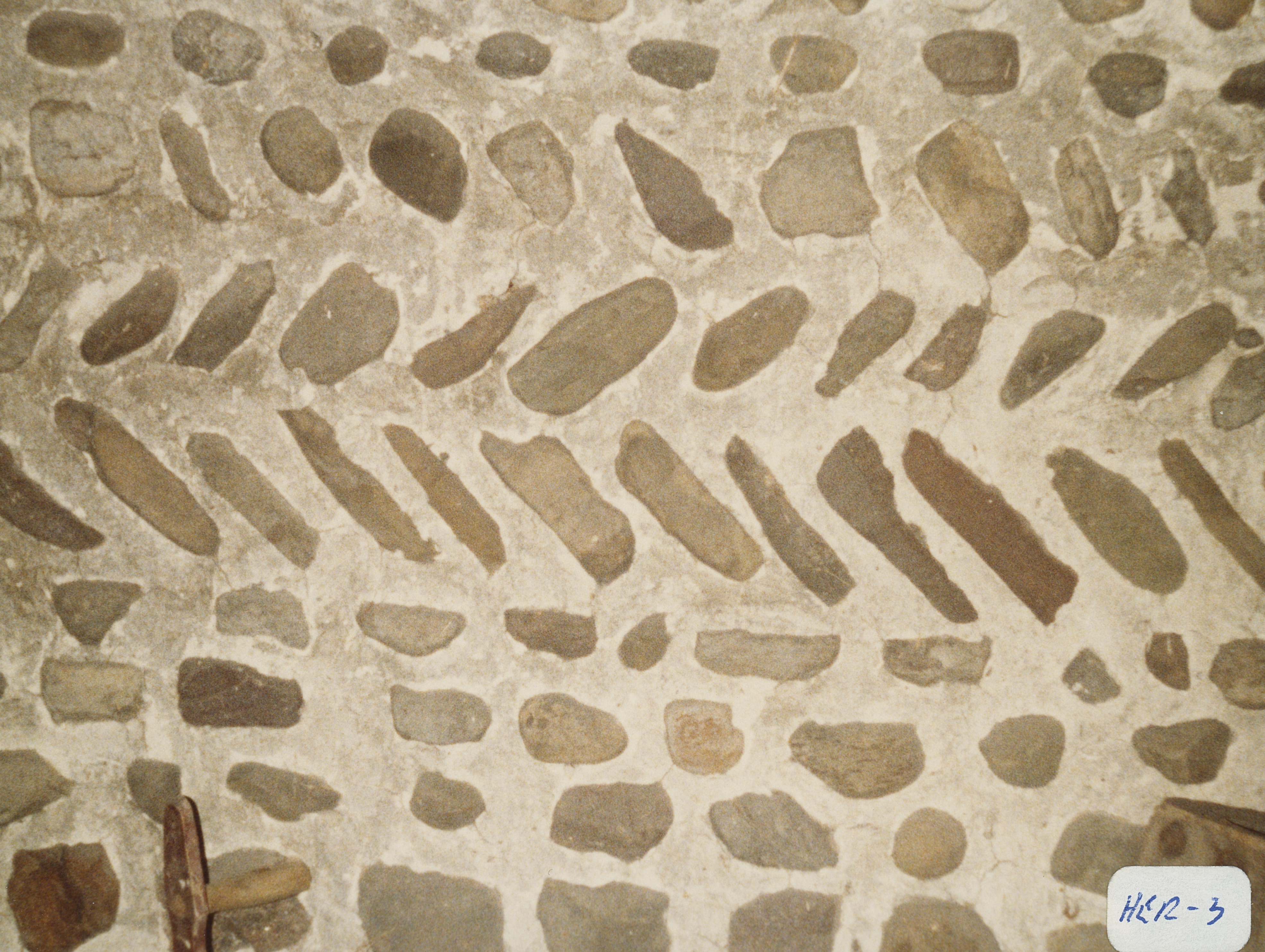
Types and uses of stones: Stones are extremely variable in size and shape and include some long thin stones. In some areas, the stones appear to be smoothed, but the vast majority are irregular and are set in a matrix of mortar which is almost flush with the stones. Inside the frame addition on the north end, the original front of the building is still intact and not weathered. In the center of this wall, stones are arranged in interesting formations which include a diamond in the center, flanked by rows of stones laid in different directions, some simulating herringbone patterns.
Types and choice of windows: The window lintels are made of gray limestone.
Structures with similar masonry details:
Masons who worked on building: Michael or Phil Burns
Unique features:
Map views courtesy Google Maps. Address is Google Earth confirmed; 42°53'08.18"N 75°10'40.50"W. Current owner of record, Davis as of date (YMD) 190411.
Town of Winfield and Herkimer County Maps
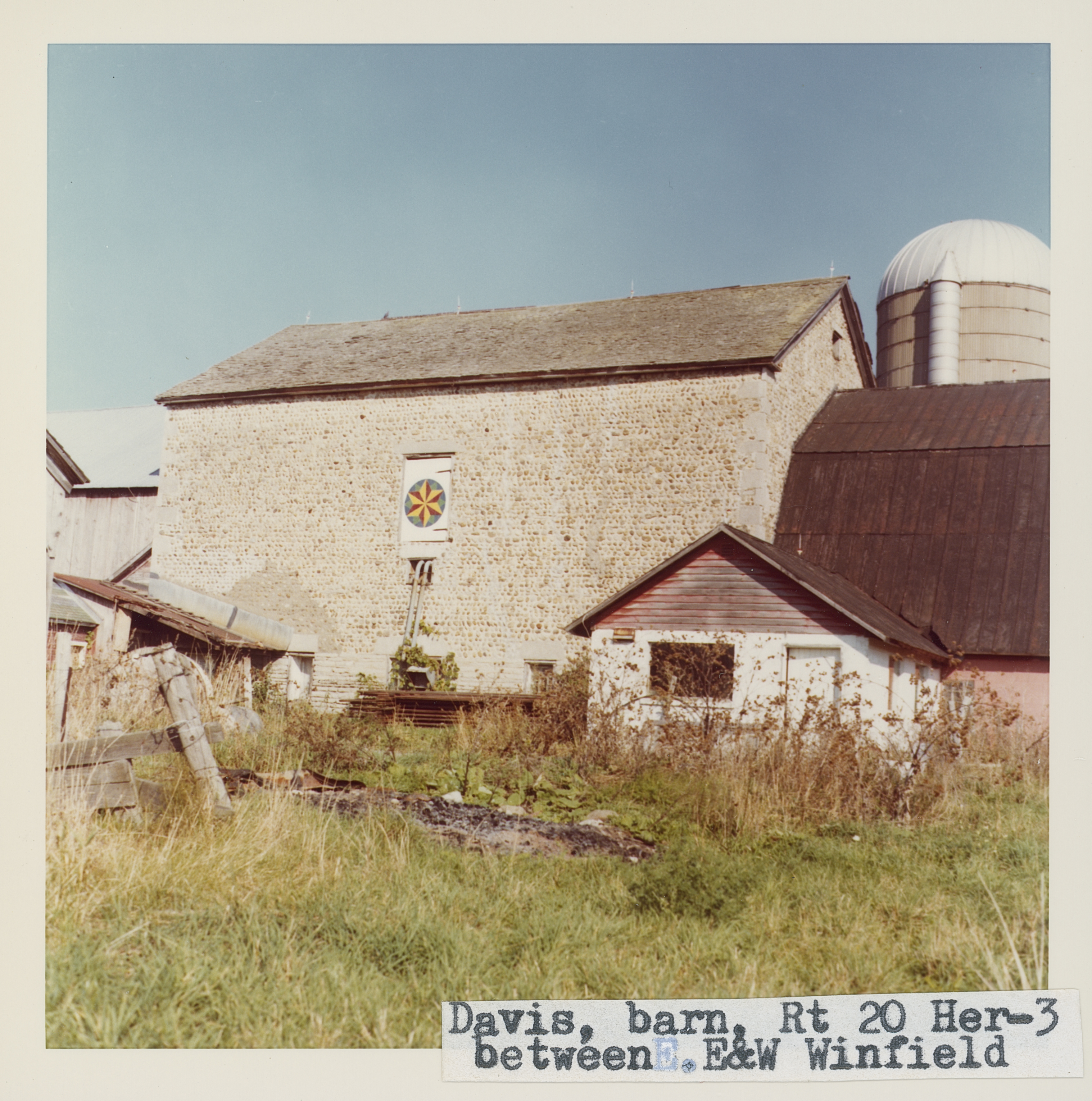
The Davis barn on the north side of Rt. 20, between East and West Winfield, is a massive structure with frame additions on both ends. The quoins are gray limestone and are variable in size. The window lintels are made of the same material. Stones are extremely variable in size and shape and include some long thin stones. In some areas, the stones appear to be smoothed, but the vast majority are irregular and are set in a matrix of mortar which is almost flush with the stones. Inside the frame addition on the north end, the original front of the building is still intact and not weathered. In the center of this wall, stones are arranged in interesting formations which include a diamond in the center, flanked by rows of stones laid in different directions, some simulating herringbone patterns. Roudabush Survey page 54.
Editor's Note: The Roudabush Survey stated the location as between East [Winfield] and West Winfield in the address. To be more accurate the barn is located just east of West Winfield, between West Winfield and East Winhield. Also the barn is located on the south side of Rt. 20, not the north side.
"New York, Herkimer County", By Allen G Noble 1985, University Akron, Akron Ohio
Cobblestone barn, roughly 45' x 30', bank construction, two stories plus loft. Built in 1849 by a local Irish mason names Michael or Phil Burns. Original owner named Bliss. Current owner is Mrs. Helen Davis, Box350, RD2, West Winfield, New York 13491. Barn is on the south side of Route 20 just east of West Winfield village. The north gable of the barn is more decorative than the other walls, but it is obscured by a later frame addition. The north wall has alternating courses of light and dark, large and small, and round and flattish fieldstone cobbles. The center of the wall contains a diamond pattern done in stone. A new tin roof was put on in 1984 and the walls are in good condition. This barn was not listed in Schmidt, but a picture is given in Wood and Stone: Landmarks of the Upper Mohawk Valley page 80.
Barn on Davis farm, 654 Route 20, West Winfield (east side). Built 1849 by Philip Burns. Richard Palmer blog.
 Win_3_1.jpg | 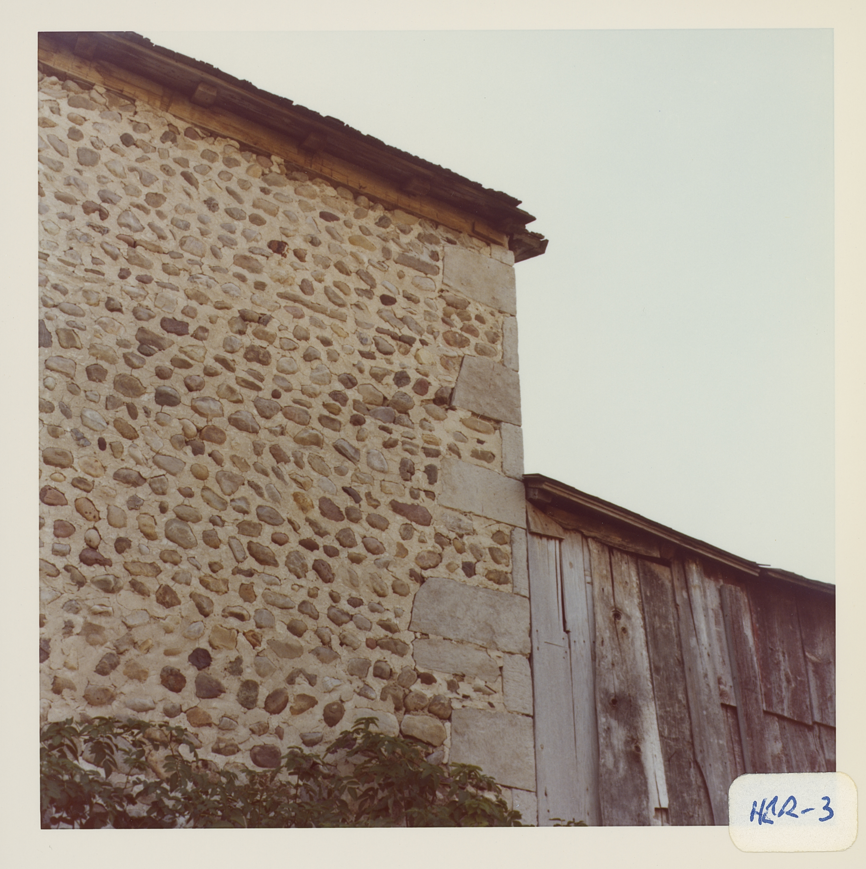 Win_3_2.jpg | 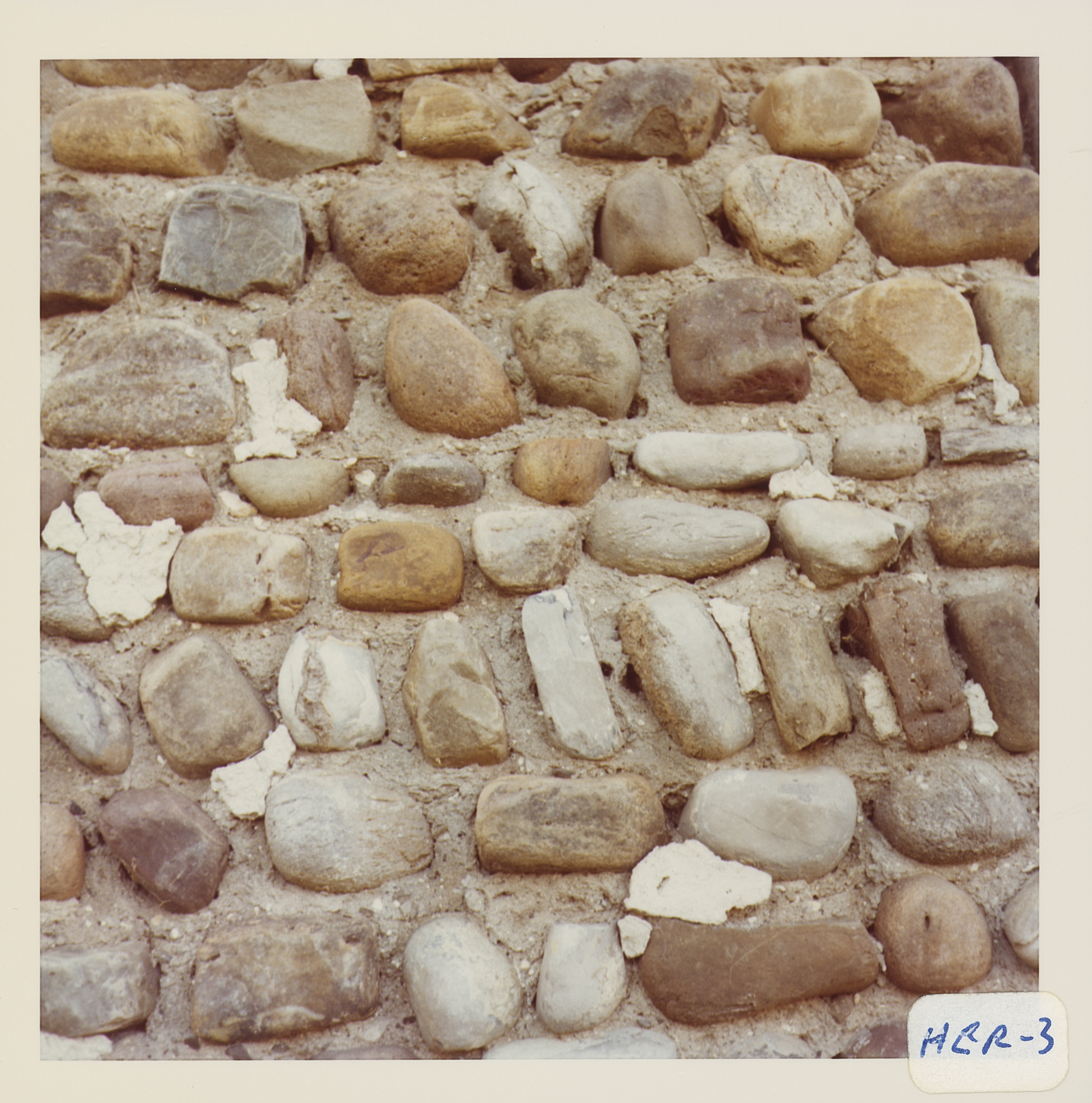 Win_3_3.jpg | 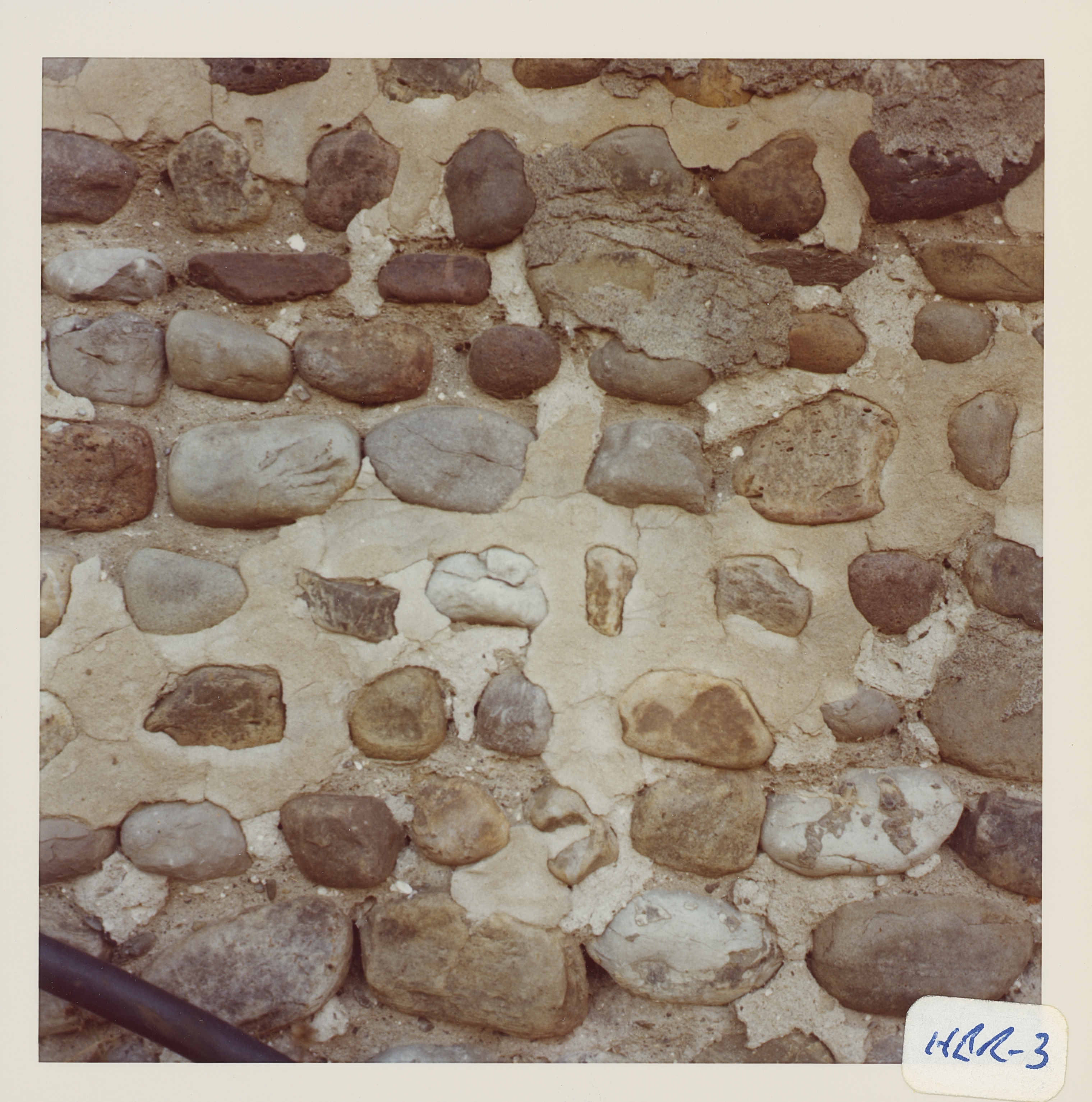 Win_3_4.jpg |
 Win_3_5.jpg | 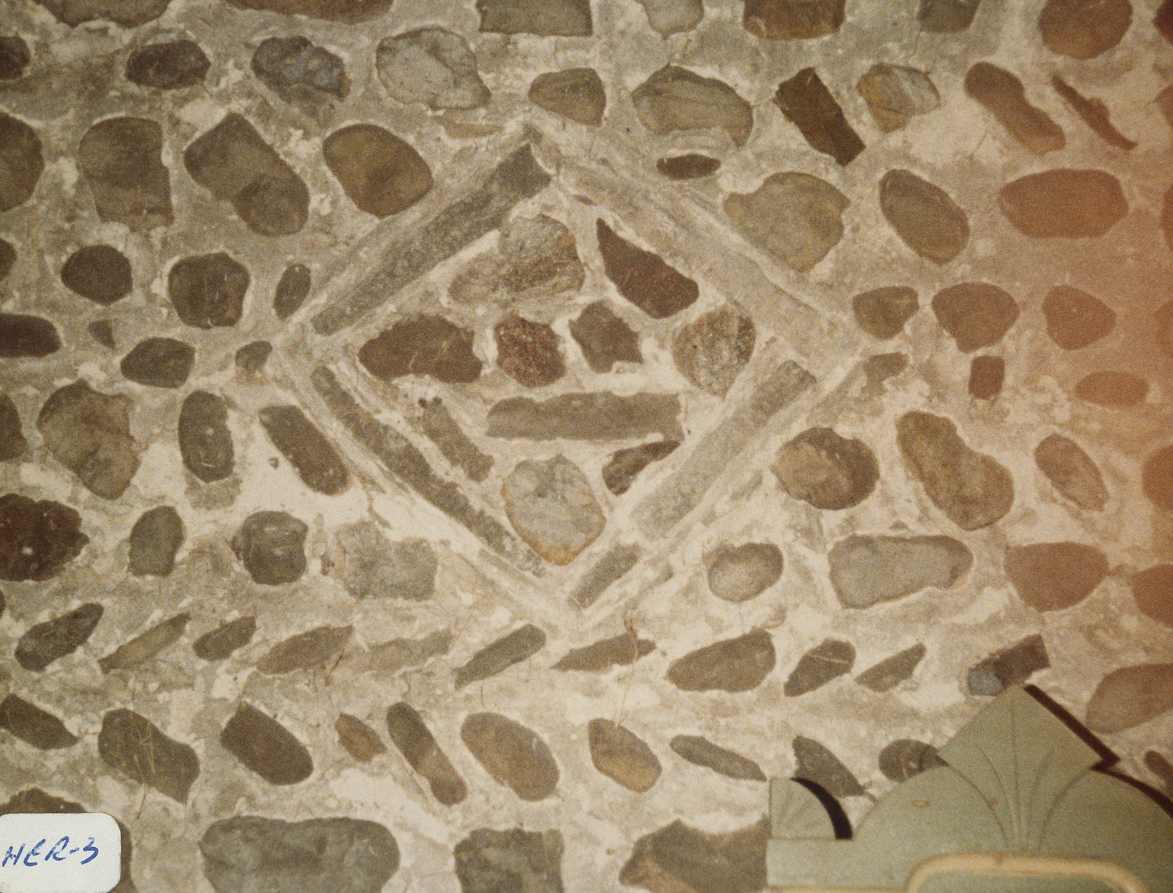 Win_3_6.jpg |  1849.jpg) 654 Route 2, West Winfield (2) 1849.jpg ¹ | 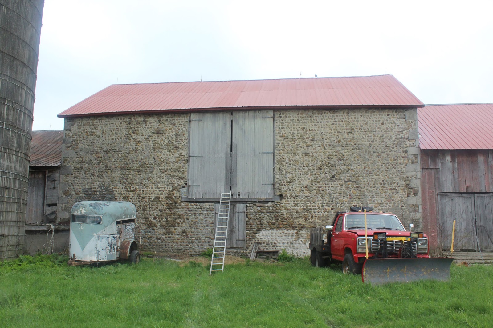 654 Route 20, West Winfield.jpg ¹ |
¹ Photography courtesy Richard Palmer.
